![Mammoth Lakes, Mono Divide [inyo and Sierra National Forests]](/store/9781566952668.jpg)
National Geographic Maps - Trails Illust
Explore the magnificent alpine landscape of Mammoth Lakes, Mono Divide with National Geographic's Trails Illustrated map. Expertly researched and created in partnership with local land management agencies, this map features key points of interest including John Muir, Ansel Adams, and Dinkey Lakes wilderness areas; Devils Postpile National Monument; and the northern portion of Kings Canyon National Park. Loaded with helpful information on wilderness camping, safety tips, and regulations, this map is an invaluable tool for casual visitors and avid adventurers alike.
The Mammoth Lakes, Mono Divide Trails Illustrated Map can guide you off the beaten path and back again with miles of mapped trails including portions of the Pacific Crest and John Muir trails. The trails are clearly marked for their usage, and mileage between intersections is noted. Road types are differentiated as well, so you know if the route you choose is a paved, dirt, four-wheel-drive, or high-clearance road. The map base includes contour lines and elevations for summits, passes and some lakes. A variety of recreation features are noted, including campgrounds, trailheads, interpretive trails, boat launch sites, horse pack stations, and more.
Every Trails Illustrated map is printed on "Backcountry Tough" waterproof, tear-resistant paper. A full UTM grid is printed on the map to aid with GPS navigation.
Other features found on this map include: Ansel Adams Wilderness, Courtright Reservoir, Dinkey Lakes Wilderness, Inyo National Forest, John Muir Wilderness, Kings Canyon National Park, Lake Crowley, Lake Thomas A Edison, Mount Darwin, Mount Goddard, Mount Morgan, Mount Powell, Mount Ritter, Nelson Mountain, Ritter Range, Sierra National Forest.
- Map Scale = 1:63,360
- Sheet Size = 37.75" x 25.5"
- Folded Size = 4.25" x 9.25"
member goods
notems store


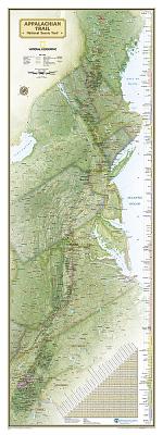
National Geographic: Appalachian Trail Wall ...
by National Geographic Maps - Reference
Calendar/Blank Book /Other$22.46

listens & views


ROSE CITY BLUES FESTIVAL / ...
by ROSE CITY BLUES FESTIVAL / VARIOUS
COMPACT DISCout of stock
$15.49